Introduction to Landsat Remote Sensing Satellites
The Landsat Series - Multispectral Scanners - Thematic Mappers - Australian Data - Web Links
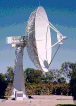
 Satellite Tracking Antenna at ACRES Alice Springs Data Aquistion Facility |
Acquiring and Archiving Landsat Images of Australia
The Australian Centre for Remote Sensing (ACRES) manages the collection of Landsat images of Australia.
Landsat MSS data have been recorded over Australia since 1972. For the period 1972-1979 coverage was intermittent. ACRES has a large selection of usable scenes in digital and photographic format covering this period. From late 1979 ACRES has archived nearly every pass over Australia and continues to receive and archive data on a daily basis.
The Landsat Thematic Mapper (TM) sensor onboard the Landsat 4 and Landsat 5 spacecrafts provides information on the Earth's surface in the visible, near, middle and thermal infrared regions of the electromagnetic spectrum. Thematic Mapper data of Australia, Papua New Guinea and South-Eastern Indonesia has been acquired in Australia by ACRES continuously since September 1987. Earlier and overseas data is available through ACRES via its distributorships with Space Imaging and the National Research Council of Thailand (NRCT).
ACRES started acquiring ETM+ image data from the Landsat 7 satellite in
July 1999. With ETM+ image data acquired daily, the ACRES archive is
the largest repository of Landsat 7 images covering Australia. ACRES
also has an agreement with the USGS enabling it to acquire overseas
Landsat 7 ETM+ data.

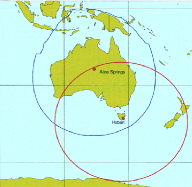
and the TERSS Hobart Data Aquisition Facilities |
ACRES Satellite Operations Section (SATOPS) was established in 1991 and is primarily responsible for planning satellite data acquisition schedules to meet the requirements of both customer programming requests and the need to provide data for ACRES' satellite data archive . This section works closely on a day to day basis with the ACRES Data Acquisition Facility (DAF) in Alice Springs to ensure that the scheduled satellites are tracked and that the data is recorded and sent to the processing facility in Canberra for cataloguing. Additionally, SATOPS also coordinates the scheduling of all optical and SAR data at the Tasmanian Earth Resources Satellite Station (TERRS) in Hobart.
Links:
1. ACRES Satellite Operations Section
2. Tasmanian Earth Resources Satellite Station