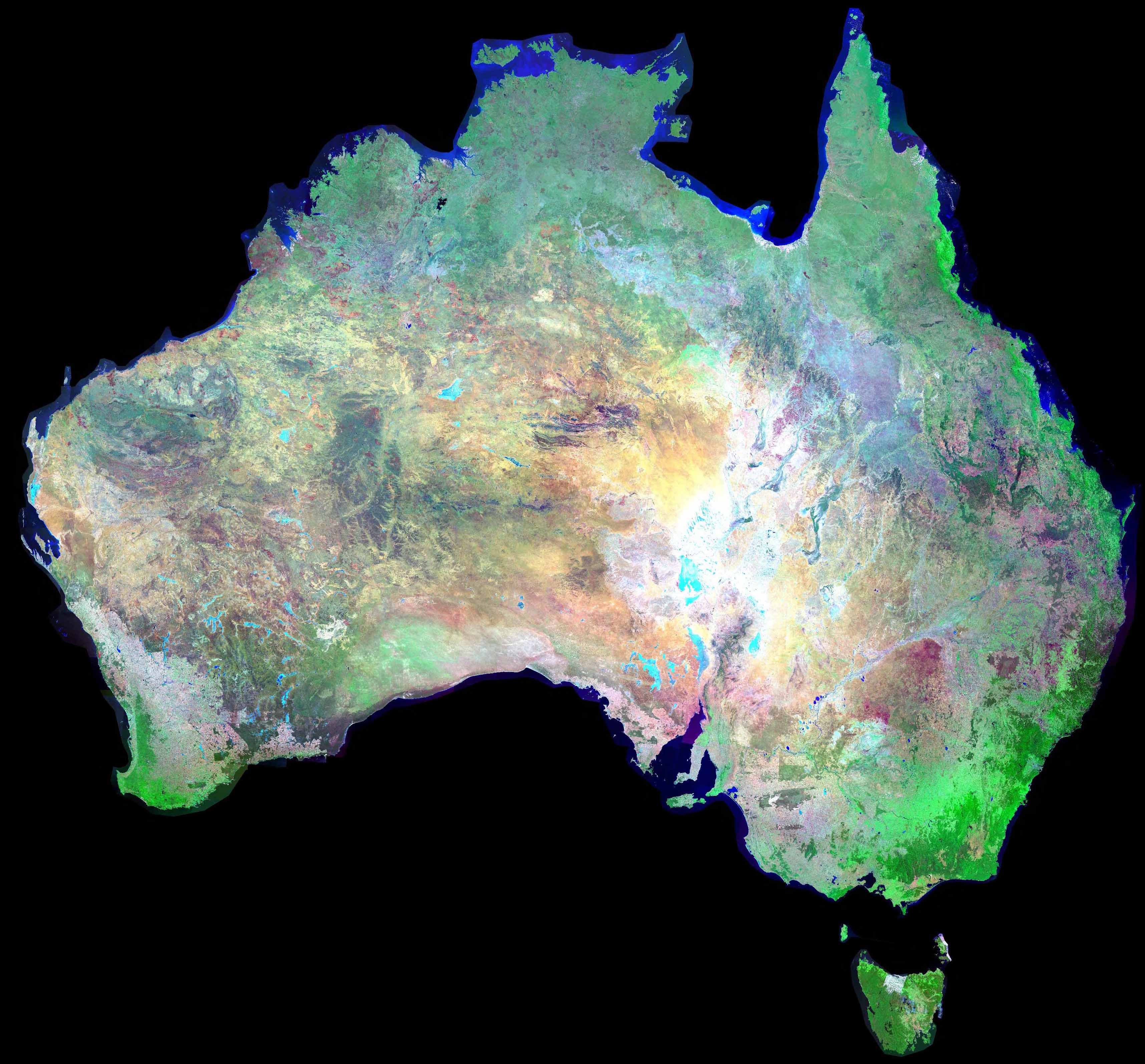
Mosaic of Australia
The Landsat 7 Picture Mosaic of Australia was produced by the Australian Greenhouse Office (AGO) as part of their National Carbon Accounting System. The mosaic is comprised of 369 individual Landsat satellite scenes acquired between July 1999 and September 2000
Specifications:
| Spectral Bands | 2,4,7 (as blue, green, red) |
| Pixel Resolution | 300 metres |
| Datum | GDA94 |
| Projection | Plate Carre (Equirectangular) |
Click on the image for a 0.8 MB version of the image .
Note: A full resolution mosaic would have 100 times more information. Full resolution Landsat 7 scenes have a 30 metres per pixel resolution.
Web Link: ACRES